The Indigenous Peoples Atlas of Canada Giant Floor Map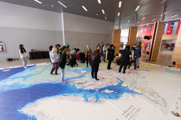
SUGGESTED GRADES: 4 TO 12
AVAILABLE: In Person
The Centre offers three distinct programs using the Royal Canadian Geographical Society’s Indigenous Peoples Atlas of Canada giant floor map. We’ll learn about the timeline and locations of Residential Schools in Canada, the different types of treaties, and gain insights into the connection Indigenous Peoples have with the land on our giant Indigenous Peoples Atlas of Canada Floor Map, created by the Royal Canadian Geographical Society.
TREATIES
Students will learn about the different types of treaties (modern and historic) and land agreements in Canada and their relevance today. They will learn to recognize and acknowledge the traditional territory they live on. They will use the timeline of the Indigenous Peoples Map to explore the treaty-making process in Canada.
RESIDENTIAL SCHOOLS
Students will explore historical relationships between Indigenous and non-Indigenous people in Canada. Using the Indigenous Peoples Map they will study the distribution of Residential Schoolsin Canada. They will be introduced to the Residential School timeline. They will reflect on the multi-generational consequences of Residential Schools.
MMIWG2S+
PLEASE NOTE THIS PROGRAM IS ONLY OFFERED FOR THE MONTHS OF MAY AND JUNE.
Why are Indigenous women, girls’ and two-spirit people at a higher risk of going missing and being murdered?
While this is a disturbing and upsetting topic, it is important to examine and discuss. The purpose of this program is to use collaborative inquiry to engage in conversations and develop an understanding of the issues surrounding missing and murdered Indigenous women, girls and 2 spirt people in Saskatchewan and Canada.
To book your classroom or school in one of our programs, contact programs@rcmphc.com